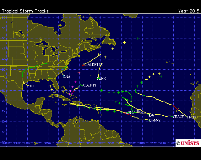
Hurricane Joaquin among the strongest storms on record in the Bahamas
According to the National Hurricane Center’s Eric Blake, Joaquin dipped to the lowest pressure of any Atlantic hurricane since Hurricane Igor in 2010. Igor’s ultimate lowest pressure was 924 millibars. For comparison, the lowest pressure on record in an Atlantic hurricane came with Wilma at 882 millibars. Other notables like Katrina weighed in with a minimum of 902 millibars, while Andrew bottomed out at 922 millibars.
Hurricane Joaquin is also coming extremely late in the season for the Bahamas — it is the first Category 4 to impact the islands so late in the season since 1866.
Unusual and intense, indeed. But it gets even more impressive.
On Thursday night, Hurricane Joaquin dropped to a very low (and strong) pressure of 931 millibars, with sustained peak winds of 135 mph. That puts the storm in fairly elite company, among the kinds of intense storms we might expect to see only every few years.
It also placed Joaquin is among the top five strongest hurricanes to impact the Bahamas on record. There have been just five known hurricanes to pass over the Bahamas with a central pressure lower (and more intense) than 940 millibars. Only three of these had a pressure lower than Joaquin’s, and none of them occurred in the month of October.
1. 922mb — Hurricane Andrew (Aug. 23, 1992)
2. 924mb — Bahamas Hurricane (Sept. 25, 1929)
3. 927mb — Hurricane Floyd (Sept. 14, 1999)
4. 931mb — Hurricane Joaquin (Oct. 2, 2015)
5. 936mb — Hurricane Frances (Sept. 2, 2004)

Hurricane Joaquin currently holds the spot for fourth-lowest surface pressure in the Bahamas since 1851. (Images: Weather Underground)
Considering the historical nature for the region, plus the painfully slow movement (other strong Bahamas storms moved quickly through the islands) it seems likely there will be horrific damage once skies clear.
What’s even more interesting about Hurricane Joaquin is that it comes amid a strong El Niño — something that typically decreases hurricane activity in the Atlantic by increasing detrimental wind shear. In general, El Niño has proved to be an atmospheric event that leads to incredibly low Atlantic hurricane activity.
But so far this year, El Niño doesn’t seem to be preventing tropical cyclone formation all that much. The number of named storms are near normal, to date. And now that we’ve had two major hurricanes — Category 3 or stronger — the season has actually outperformed many of the seasonal forecasts that were issued in the spring.
According to Phil Klotzbach, a hurricane researcher at Colorado State, Hurricane Betsy of 1965 is considered to be the most notorious El Niño hurricane on record. Betsy made landfall in Florida and then strengthened into a Category 4 in the Gulf of Mexico and struck Louisiana. Betsy might be best described as a Katrina before the Katrina.
So El Niño can certainly produce some intense hurricanes, and Joaquin is further proof of that.
When it comes to this year’s activity, and Joaquin in particular, Klotzbach noted that El Niño typically reduces storm activity in the deep tropics. But in this case, “Joaquin intensified more in the subtropics, where El Niño has less of an impact,” he said.
Perhaps it has something to do with all the warm water out there.


No comments:
Post a Comment